Focus on EcoScope Models: The Adriatic Sea ecosystem model
Authors: Giuseppe Scarcella, CNR and Simone Libralato, OGS
A food web model was developed by the OGS and CNR team for the GFCM Geographical Sub Areas (GSA) 17 and 18 to support ecosystem-based fisheries management (EBFM). The Adriatic Sea is a semienclosed basin characterised by high productivity due to important freshwater inputs and a very extended shelf, which has been heavily trawled for decades. The six countries on the Adriatic sea shores host fisheries with different degrees of development, capacity and history of exploitation that is carried out through a wide series of gears and targeting several fish species.
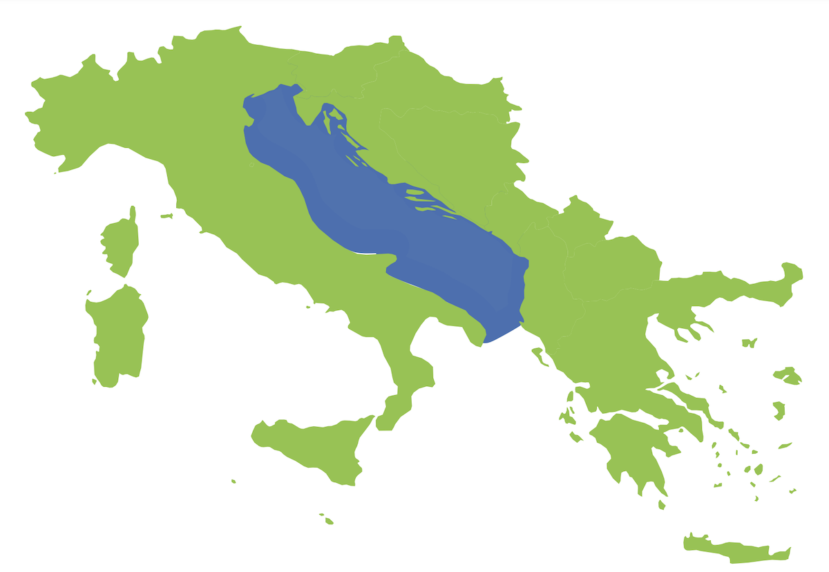
Map of the Adriatic Sea Ecosystem Model
The food web model describes the ecosystem, which covers an area of approximately 120,000 km2 from shore to 800m depth, through 73 functional groups that describe the priority species (in age classes), other species with commercial importance, species of ecological importance, plus all other components of the ecosystem from plankton to top predators.
The Adriatic fisheries are described through 33 fishing fleets that result from a combination of gear, and segments based on the vessel’s length overall (LOA) and countries.
Data for the years 2004-2006 are used to develop the Ecopath steady-state network model whose realism and accuracy were tested using comparison with stable isotope results as well as checking the consistency of parameters across the trophic level with ecological rules (Prebal).
The time dynamic module Ecosim was run from 2000 to 2020 using as bottom-up drivers of phytoplankton (diatoms, dinoflagellates), zooplankton (micro-, meso and macro-zooplankton), bacterioplankton and detritus groups (suspended detritus and bottom detritus) biomass obtained from the 3D biogeochemical model for the Mediterranean (MedBFM). The top-down forcing used was the fishing effort dynamics over the 2000-2022 reconstructed combining different sources of data, including VMS for Croatia and Italy by gear and fleet segment. The resulting dynamics were calibrated for the years 2000-2018 using fishery-independent data from MEDITS and SOLEMON trawl surveys and results from SAC-GFCM stock assessments.
Within the EU-funded project EcoScope, the calibrated Adriatic model will be used to test uncertainty on bottom-up and top-down forces on ecosystem dynamics, indicators and management actions. This will allow us to better disentangle the role of historical changes in productivity and effort on the dynamics of renewable resources at sea. Moreover, the model will be used to test fisheries management alternatives by running the model up to 2050 under alternative management and climate scenarios. Results are expected to provide spatiotemporal information on the effects of management and might be used to support policymakers.
Focus on regional EcoScope models
Within EcoScope, eight case-study areas are identified: The Bay of Biscay, The Aegean Sea, The North Sea, The Israeli EEZ, The Black Sea, The Balearic Islands, The Western Baltic Sea, and The Adriatic Sea.
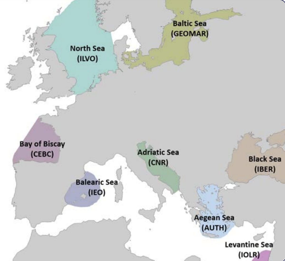
Map of the European and Levantine Seas highlighting 8 case studies regions investigated